Urban communities are often highly developed built environments where encounters with the natural world is experienced in a narrow capacity. In a built environment, the natural world is encountered through the foods that people eat and the places people exercise and spend their leisure time. Inaccessibility to healthy food outlets and places to exercise and experience the natural world is often a result of public policy or lack thereof. Through the Partnerships for Environmental Public Health (PEPH), researchers, community organizations and community members may identify local environmental health issues, research these issues and formulate policy to reduce the adverse effects these issues have on communities and promote forward steps towards healthy community living.
New York City (NYC) is a highly developed urban area with great spatial disparity in built environmental conditions. Columbia University’s Built Environmental Health Project (BEH) group and local community organizations have worked jointly in identifying and mitigating local environmental health issues. Since these issues are consequences of the urban landscape, geospatial data plays an important role in understanding where communities lack the essential features to promote healthy lifestyles.
Using existing NYC Geographic Information Systems (GIS) data and creating new data relevant to the environmental issues at hand, it is possible to solve analytical questions and identify specific locations where new outlets may be developed to promote public health and community engagement. BEH and community organization partners have been engaged in studies that explore park accessibility and access to healthy food outlets as environmental health issues.
ASPIRA: Analyzing Potential Community Garden Sites in the South Bronx
Summary: The aim of this project is to identify potential community garden sites in the South Bronx using NYC MapPluto (Department of City Planning Tax Block and Lot GIS data) to isolate city-owned, vacant tax lots, and create maps of these properties for the ASPIRA youth to conduct field surveys. The concept is that city-owned vacant lots may be easy to convert into community gardens where fresh food may be grown for the local community and as a place to teach the youth about urban agriculture and the natural world. The ASPIRA youth have conducted their own field surveys to verify lot vacancy and created detailed data to identify prime locations for community gardens that are near the schools they attend and receive adequate sunlight for growing fruits and vegetables.
About: ASPIRA is a youth-oriented community organization. ASPIRA engages the local youth though educational experiences and field trips to better their understand of possible career paths and help their community.
Community District 4: Mapping Existing and Potential Sites for Alternative Food Outlets in Bushwick
Sumary: The purpose of this partnership with Community District 4 in Bushwick, Brooklyn was to take an inventory of existing alternative food outlets in the Study Area and identify potential locations for community gardens, community-supported agriculture (CSAs) and farmers markets. Using NYC MapPluto data, unused vacant, city-owned properties may be utilized for constructing new community gardens. New farmers markets and CSAs may be organize at existing city-owned locations as well as existing community organizations that serve as Food Banks.
About: Community District 4 (CD4) serves the neighborhood of Bushwick, Brooklyn. In 2006 CD4 was identified as having a 29% obesity rate in the NYC Department of Health and Mental Hygiene report. The Center for Disease Control estimated the 2008 New York State obesity rate at 24%.
Transportation Alternatives: Analyzing the Need for Play Streets near Public and Private Schools in The Bronx
Summary: BEH and Transportation Alternatives will analyze children’s access to open play space near schools in the Bronx and identify streets that may be closed to create more open space for children to play and spend their free time. Based on a list of schools without play areas, NYC Department of Transportation (DOT) data and other information it is possible to construct a list of schools that have little to no outdoor space and are near streets that may easily be closed to create a temporary public space to be used for exercise and community activities.
About: Transportation Alternatives (TA) is a pedestrian, bicycle and mass-transit advocacy group. Their goals are to improve the quality of life in New York City by limiting automobile traffic and encouraging more New York City residents to ride bicycles, walk or take mass-transit. TA works with New York City government and community organizations to create a more sustainable transportation network that lessens reliance on car-ownership.
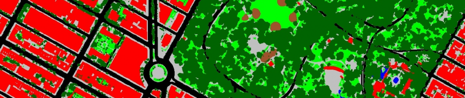
NYC Parks Accessibility: Measuring Accessibility and Environmental Impediments
Summary: This study is an assessment of different measures of accessibility New York City residents have to parks based on proximity as well as impediments to park attendance and an analysis of comparing parks’ value based on size and park facility amenities. Based on a quarter-mile straight-line distance buffer from census tracts, it is possible to aggregate the local park environment variables to paint a picture of park accessibility throughout New York City. Preliminary findings, such as the number of parks within the quarter-mile buffer of the census tracts, reveal that there is a positive association with the number of parks in an area and populations of African Americans and Latinos. However, a closer examination reveals that these parks are often smaller, of lesser quality, have few park amenities and have greater impediments to attendance. Quite simply, the number or parks in a census tract’s proximity does not encourage park attendance. There are many variables that do not favor park attendance. Also, in quarter-mile buffer areas surrounding census tracts, areas of higher minority populations have less acreage of park space. So the number of parks in proximity of a census tract may be high but that does not mean that the amount of park space available to a resident is attractive enough to encourage park attendance.
The Point: Analyzing Community Access to Parks and Green Space in the South Bronx
Summary: The aim of this study was to compare census block access to parks in the South Bronx and the Upper East Side of Manhattan. The census blocks in the study area were buffered by one-quarter mile and intersected with the Parks and Park Amenities (features such as football fields, multipurpose fields, pools, etc.) Initial analysis for The Point yielded results that showed that there was not significantly less park accessibility in the South Bronx than in the comparative area of the Upper East Side of Manhattan. This however does not reflect the overall quality of parks in the two study areas. Also, this study does not include impediments as a measure for evaluating parks.
About: The Point is a community-oriented organization based in the South Bronx, specifically in the Hunts Point area. This area has some of the lowest income rates in the country and is rife with public health issues, particularly asthma. The Point offers art programs and community-based activism promoting culture and community development.

