Search the Site
-
Join 1,585 other subscribers
-
Recent Publications
Facebook Page

Author Archives: Built Environment and Health
JAMA on Walking and Walkability
Following up on its two recent articles about neighborhood walkability, including an editorial co-authored by Andrew Rundle, JAMA today published a Medical News and Perspectives article entitled “As Walking Movement Grows, Neighborhood Walkability Gains Attention”. The article notes the various … Continue reading
Posted in Physical Activity, Walkability
Leave a comment
Steve Mooney receives Poster Award at Epidemiology Congress of the Americas 2016
Steve Mooney, a recently minted PhD who did his doctoral work with the BEH group, won a best poster presentation award at the 2016 Epidemiology Congress of the Americas for his work on the Neighborhood Environment-Wide Association Study design. Dr. … Continue reading
Urban Design to Support Walking and Health
JAMA just published an editorial co-written by, Andrew Rundle, entitled “Can Walkable Urban Design Play a Role in Reducing the Incidence of Obesity-Related Conditions?”. The editorial provides a perspective on a study published in JAMA by Creatore et al., that … Continue reading
Posted in Uncategorized
Leave a comment
Can Big Data get us Better Estimates of Neighborhood Disorder?
At the Built Environment and Health group, we try hard to measure neighborhood characteristics accurately. We systematically audit Street View imagery, we use LiDAR scans to assess tree canopy, and we use business registration records to profile neighborhood retail. A … Continue reading
Posted in Methods, Physical Disorder, Street View
Leave a comment
Maintaining Human Subject’s Protections in Neighborhood Health Effects Research
We recently published a commentary in the American Journal of Public Health describing the concerns we have for protecting study subject anonymity with the use of online geographic and data tools in neighborhood health effects research. Examples of neighborhood data available … Continue reading
Posted in Methods, Tools, Uncategorized
Leave a comment
Measuring Pedestrian Activity Using GPS Logger Data
It has been suggested that GPS monitoring data can be used to estimate distances traveled and speeds of travel during active and non-active travel journeys and, that when combined with accelerometer monitoring, GPS data can be used to identify travel … Continue reading
Posted in Active Transport, GPS, Physical Activity
Leave a comment
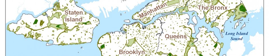
Maps of Neighborhood Physical Disorder
The Journal of Maps recently published our article showing a high resolution map of neighborhood physical disorder in New York City. Physical disorder – the deterioration of urban spaces owing to social forces favoring neglect and abandonment – has long been … Continue reading
Posted in Uncategorized
Leave a comment
Our Pedestrian Injury Research gets Further Coverage.
The Mailman School blog reached out to Steve Mooney to discuss our research on pedestrian injuries. The post shows a series of Street Views of the key features that were associated with injuries. The article is Here. And an article … Continue reading
Posted in Uncategorized
Leave a comment
Using Google Street View to Understand Pedestrian Injury Risk
In 2013, an estimated 70 000 pedestrians were injured or killed by motor vehicles in the United States. In New York City more pedestrians than vehicle occupants have been killed by motor vehicles each year since at least 1910. Pedestrian … Continue reading
Posted in CANVAS, Pedestrian Injury, Safety, Street View
2 Comments
Using GPS and Accelerometers to Study Neighborhood Walkability and Physical Activity
We just published a paper in the American Journal of Preventive Medicine showing that differences in residential neighborhood walkability in New York City (NYC) are associated with how residents utilize neighborhood space and are associated with total weekly physical activity. Higher neighborhood … Continue reading
Posted in Accelerometers, GPS, Physical Activity, Walkability
Leave a comment

